
Anomalous ridge instead of cyclones: models predict prolonged heat in the Kirov region
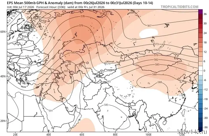
The atmospheric situation over northern Eurasia shows signs of serious restructuring. According to recent calculations from ensemble meteorological models (in particular, EPS), covering the forecast period until the end of July, a powerful upper-level ridge is forming in the middle troposphere. On synoptic maps, it is expressed as an extensive zone of positive geopotential anomalies, visually colored in warm tones, extending from the Urals to the west, including the Kirov region.
For specialists, this development appears unusual, considering seasonal climatology. Traditionally, during the summer months, the European part of Russia is under the influence of barometric troughs, which are conduits for cyclonic vortices. These typically provide the region with rainy and less sultry weather. However, current calculations indicate a shift in this familiar mechanism: an extensive anticyclonic ridge is replacing the low pressure.
In meteorology, such formations are classified as blocking processes. Their main feature is the ability to "lock" Atlantic cyclones for an extended period as they approach the continent, forcing them to bypass the high-pressure zone from the north or south. The consequence of such an atmospheric barrier for the Kirov region is the establishment of dry and hot weather, as solar radiation freely warms the air masses, while cloudiness and precipitation retreat.
Notably, this scenario is recorded against the backdrop of an active phase of El Niño in the Pacific Ocean. Although the direct influence of this global phenomenon on local processes is difficult to trace, the current anomalous restructuring of circulation is of interest to meteorologists accustomed to a different summer pattern for these latitudes.
The main uncertainty in current forecasts remains the stability of this blocking ridge. Models show a high probability that the hot weather will persist for at least a week; however, the ultimate duration of the anticyclonic period remains in question. Forecasters will continue to monitor the situation, as the speed of the breakdown of this upper-level "dome" will determine when the usual summer rains will return to the Kirov region. In the coming days, residents of the region should rely on timely updates to forecasts to adjust their plans in light of the increasing heat.
Другие Новости Кирова (НЗК)
 Энергетики предупреждают о рисках рыбалки вблизи линий электропередач.
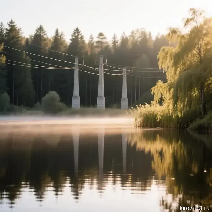
В администрации Кирова отметили, что в последнее время участились случаи электротравматизма во время рыбалки рядом с линиями электропередачи. В этой связи работники энергетической компании напоминают, что в охранных зонах линий электропередачи запрещено ловить рыбу и других водных обитателей.
Энергетики предупреждают о рисках рыбалки вблизи линий электропередач.
В администрации Кирова отметили, что в последнее время участились случаи электротравматизма во время рыбалки рядом с линиями электропередачи. В этой связи работники энергетической компании напоминают, что в охранных зонах линий электропередачи запрещено ловить рыбу и других водных обитателей.
 С начала лета в водоемах региона погибло 8 человек.
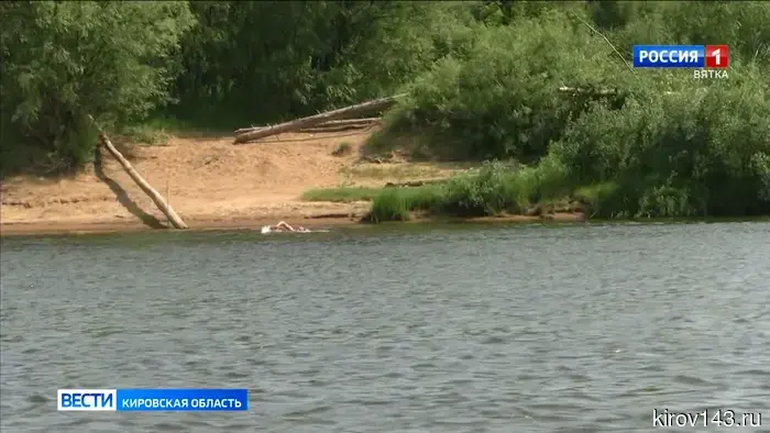
В МЧС вновь озвучили рекомендации по безопасности при отдыхе у водоемов. Согласно оперативной информации, с начала лета в Кировской области утонуло 8 человек. Четверо из них погибли во время купания, в том числе двое детей, и еще четверо — во время рыбалки. На ближайшие дни синоптики предсказывают высокие температуры. В МЧС еще раз
С начала лета в водоемах региона погибло 8 человек.
В МЧС вновь озвучили рекомендации по безопасности при отдыхе у водоемов. Согласно оперативной информации, с начала лета в Кировской области утонуло 8 человек. Четверо из них погибли во время купания, в том числе двое детей, и еще четверо — во время рыбалки. На ближайшие дни синоптики предсказывают высокие температуры. В МЧС еще раз
 В Кировской области работники Росгвардии осуществляют проверки владельцев огнестрельного оружия.
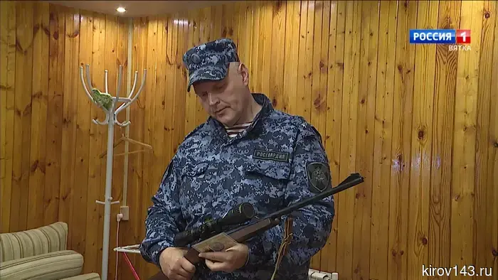
На учете в подразделениях лицензионно-разрешительной работы Управления Росгвардии по Кировской области находится свыше 24 тысяч владельцев гражданского оружия, имеющих в собственности более 46 тысяч единиц. На прошлой неделе сотрудники подразделения провели 125 проверок владельцев.
В Кировской области работники Росгвардии осуществляют проверки владельцев огнестрельного оружия.
На учете в подразделениях лицензионно-разрешительной работы Управления Росгвардии по Кировской области находится свыше 24 тысяч владельцев гражданского оружия, имеющих в собственности более 46 тысяч единиц. На прошлой неделе сотрудники подразделения провели 125 проверок владельцев.
 The OBZR is divided into two courses: eighth graders and tenth graders will have military training added.
The Ministry of Education is changing its approach to teaching "Fundamentals of Safety and Defense of the Motherland." Instead of one subject, there will be two mandatory modules in the schedule.
The OBZR is divided into two courses: eighth graders and tenth graders will have military training added.
The Ministry of Education is changing its approach to teaching "Fundamentals of Safety and Defense of the Motherland." Instead of one subject, there will be two mandatory modules in the schedule.
 Taurus should not be stingy with money, while Aquarius will be talkative.
Astrologers revealed what the last working day of the week will be like for each zodiac sign.
The drunk driver from Kirovo-Chepetsk received a harsher sentence for a fatal car accident.
The appellate court increased the prison sentence for a resident of Kirovo-Chepetsk, who, while under the influence of alcohol, fatally struck a 79-year-old cyclist.
Taurus should not be stingy with money, while Aquarius will be talkative.
Astrologers revealed what the last working day of the week will be like for each zodiac sign.
The drunk driver from Kirovo-Chepetsk received a harsher sentence for a fatal car accident.
The appellate court increased the prison sentence for a resident of Kirovo-Chepetsk, who, while under the influence of alcohol, fatally struck a 79-year-old cyclist.
Anomalous ridge instead of cyclones: models predict prolonged heat in the Kirov region
The usual July weather rhythm in the Kirov region, shaped by a series of Atlantic cyclones, may soon be interrupted. According to global ensemble forecasts, a vast area of high pressure is gaining strength over the Ural region, which could change the usual circulation of air masses. If the current calculations are confirmed, the residents of the region will face a prolonged and hot period without significant precipitation.