

More than 3,000 plots in the Kirov region have received boundaries in the State Real Estate Cadastre: what threatens owners without coordinates.
In the Kirov region, work continues on filling the Unified State Register of Real Estate (EGRN) with accurate data on the boundaries of land plots. In just the first three months of 2026, specialists processed information on the location of boundaries for more than 3,000 objects.
However, as Svetlana Oskolkova, the deputy head of the cadastral accounting department, reminds us, an important restriction has been in effect for over a year. Since March 1, 2025, a rule has come into force that is directly tied to the presence of boundaries in the EGRN.
If the boundary information has not yet been entered, the owner will not be able to:
- conduct any registration actions with the land plot itself;
- register a building, structure, or unfinished construction located on it;
- formalize rights to such objects.
In other words: no boundaries in the register — no possibility to legalize either the land itself or the buildings on it.
How to check if the boundaries have been entered right now?
The fastest and free way is the public cadastral map on the website nspd.gov.ru/map. It is enough to enter the cadastral number or address. If the plot is displayed graphically on the map — it means that the information about its boundaries is already in the EGRN, and there should be no problems with registration.
An alternative option is to order an extract from the register in paper or electronic form. This can be done through the MFC, the "Gosuslugi" portal, or the official website of Rosreestr. The extract will indicate the coordinates of the characteristic boundary points if the data has been entered.
How to add boundaries to the EGRN if they are still not there?
The procedure is standard and has not changed. The right holder needs to contact a cadastral engineer. The specialist goes to the site, takes measurements, and prepares a boundary plan — strictly according to the requirements of Rosreestr Order No. P/0592. Then the owner submits an application for accounting changes, attaches the boundary plan, and pays the state duty (Article 333.33 of the Tax Code).
The press service emphasizes: practice shows that the absence of precisely defined boundaries remains the main reason for conflicts between neighbors over land plots. Clarifying boundaries not only resolves formal issues with the register but also prevents land disputes for years to come.
Другие Новости Кирова (НЗК)
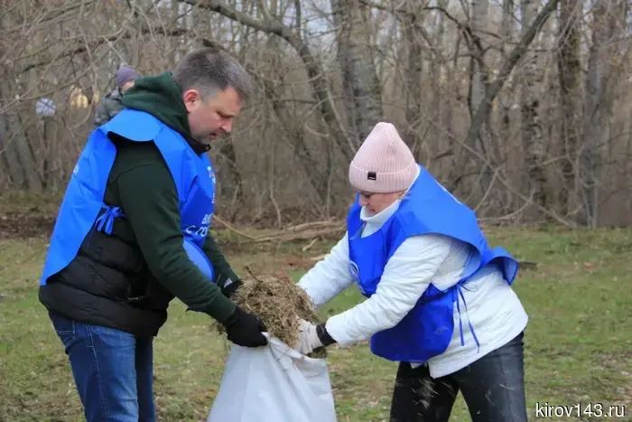 The branch "KCHKC" organized clean-up days in Kirovo-Chepetsk.
The branch "KCHHK" of JSC "OHC "Uralchem" participated in the events for cleaning and landscaping Kirovo-Chepetsk.
The branch "KCHKC" organized clean-up days in Kirovo-Chepetsk.
The branch "KCHHK" of JSC "OHC "Uralchem" participated in the events for cleaning and landscaping Kirovo-Chepetsk.
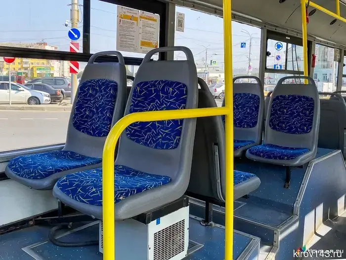 Special routes to cemeteries will be launched for Kirov residents.
On May 9, special bus routes will be organized for Kirov residents to the city cemeteries.
Special routes to cemeteries will be launched for Kirov residents.
On May 9, special bus routes will be organized for Kirov residents to the city cemeteries.
 Before May 9, a quiet turn is activated: everything will start to change for these signs.
Sometimes the most important shifts happen quietly, almost imperceptibly. Without sharp events and external signals — but with a clear internal feeling: something is no longer the way it used to be.
Before May 9, a quiet turn is activated: everything will start to change for these signs.
Sometimes the most important shifts happen quietly, almost imperceptibly. Without sharp events and external signals — but with a clear internal feeling: something is no longer the way it used to be.
 Special routes to cemeteries will be launched for Kirov residents.
On May 9, special bus routes will be organized for Kirov residents to the city cemeteries.
Special routes to cemeteries will be launched for Kirov residents.
On May 9, special bus routes will be organized for Kirov residents to the city cemeteries.
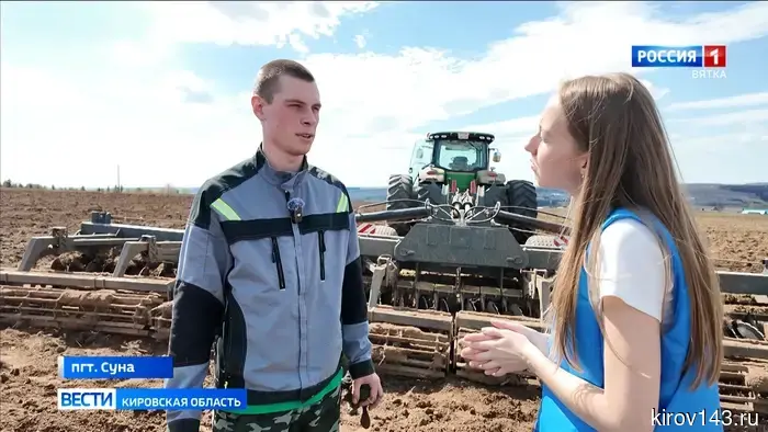 Студент из Нолинска признан лучшим механиком в России.
Илья Максимов, учащийся Нолинского техникума механизации сельского хозяйства, занял первое место в России в области эксплуатации сельхозтехники. На межрегиональном этапе чемпионата «Профессионалы» он стал победителем в своей профессиональной компетенции, обойдя сильнейших конкурентов. В настоящее время он проходит практику.
Студент из Нолинска признан лучшим механиком в России.
Илья Максимов, учащийся Нолинского техникума механизации сельского хозяйства, занял первое место в России в области эксплуатации сельхозтехники. На межрегиональном этапе чемпионата «Профессионалы» он стал победителем в своей профессиональной компетенции, обойдя сильнейших конкурентов. В настоящее время он проходит практику.
 A resident of Pizhanka gave away 964 thousand due to a phone conversation.
A 49-year-old resident of Pizhanka followed the instructions of strangers who claimed to be employees of the pension fund, State Services, Roskomnadzor, and the FSB. As a result, the woman traveled to a neighboring region and transferred almost a million rubles to the scammers herself.
A resident of Pizhanka gave away 964 thousand due to a phone conversation.
A 49-year-old resident of Pizhanka followed the instructions of strangers who claimed to be employees of the pension fund, State Services, Roskomnadzor, and the FSB. As a result, the woman traveled to a neighboring region and transferred almost a million rubles to the scammers herself.
More than 3,000 plots in the Kirov region have received boundaries in the State Real Estate Cadastre: what threatens owners without coordinates.
In the first quarter of 2026, the Rosreestr for the Kirov region entered information about the boundaries of more than 3,000 land plots into the Unified State Register of Real Estate. The agency reminds that starting from March 1, 2025, the absence of precise boundaries in the USRN will already be an obstacle to the registration of land rights and the accounting of any buildings on it.